Drone Lidar Inspections
WE PROVIDE DRONE LIDAR SERVICES FOR:
- Surveyors & Engineering Firms
- As-Built Mapping & Modeling
- Land Development
- Forestry & Geosciences
- Mining
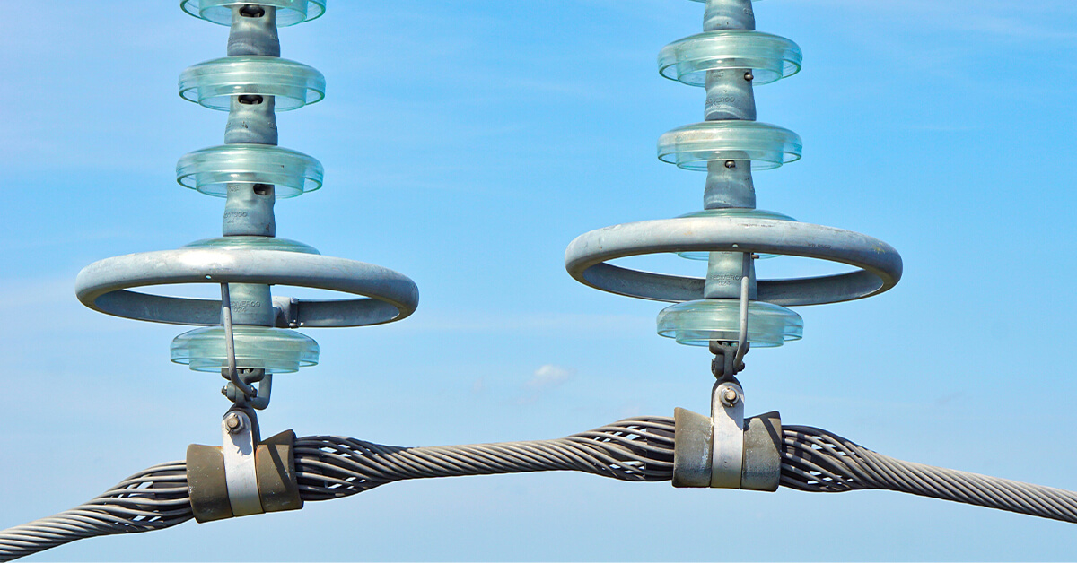
- Energy & Utilities
- Oil & Gas
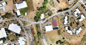
- Critical Infrastructure Inspections
- Transmission Distribution/Power Lines
- Topographic & Bathymetric Surveying

Our experienced lidar solutions professionals can map up to 1500 acres per day anywhere in the United States, Canada, and the Caribbean. To accomplish this kind of large-scale lidar mapping data requires more than just your off-the-shelf software. Site specific data processing and complex post-production techniques must be employed to remove any excess noise and unnecessary data artifacts from point cloud models to achieve commercial grade high quality deliverables. Volatus Aerospace delivers drone lidar mapping at scale with more efficiency than anyone else in the industry at competitive prices.
At Volatus Aerospace, our skilled team of professionals works in harmony to deliver professional industry-standard results for each project’s unique requirements. In addition, with the help of our trusted technology providers we are also able to process and incorporate expansive lidar datasets into your workflow and provide actionable results that help you weed through the data for what you need. Our lidar services can save you time and money, while multiplying your workforce by outsourcing your data collection and analysis leaving your teams to focus on what you do best: getting work done.
WHAT IS DRONE LIDAR TECHNOLOGY AND HOW DOES IT IMPROVE YOUR WORKFLOWS?
Lidar (Light Detection and Ranging) processes information similar to how sonar or radar detects objects. Rather than hitting objects with a sound or radio wave, it sends a series of hundreds of thousands laser pulses per second at a target. This allows a lidar-equipped drone to collect highly accurate measurements of an object’s distance and dimensions by measuring the time it takes for each laser pulse to bounce back.
Unlike photogrammetry, which can only capture the surfaces of objects captured by an RGB camera , lidar’s laser light pulses can penetrate foliage and other obstructions. This creates levels of detail unattainable through traditional means and is ideal for capturing surfaces obscured by brush, trees, and other vegetation. Our post-processing process georeferences and classifies the data points based on what reflects back; these classification categories include bare earth/ground, top canopy coverage, and water. These points are then processed into a 3D model called a point cloud.
Using lidar, it’s now possible to capture terrain and vegetation down to a centimeter level of accuracy. These three-dimensional point cloud models provide invaluable information that enables us to provide you with sophisticated analysis. With all of its capabilities, drone lidar services are quickly becoming an invaluable resource across many industries ranging from urban planning and construction to forestry and precision agriculture.
The Volatus Difference
Lidar is one of the core strengths and abilities of Volatus Aerospace. We combine aerial lidar with handheld and mobile SLAM (Simultaneous Localization and Mapping) lidar to provide unparalleled point cloud density and data extraction. Using our lidar data, we can determine tree densities, stocking levels, expected yield of a given area, and perform regression analyses.
The result is that our clients are able to get an in-depth, accurate, and precise three-dimensional model of their assets, which enables them to make timely and informed decisions and track changes over time.
Drone lidar services
At Volatus Aerospace, we strive to make the process easier for you, not more complicated. We manage the entire process, including piloting the drones, capturing the content and data you need, and delivering actionable insights in a convenient, cloud-based platform. Our nationwide mission-based drone flight plans are enforced by our experienced, knowledgeable, and professional certified drone pilots, data analysts, and software engineers.
Contact our team of experts today for a FREE lidar drone service quote.


