The team uses the Astralite Edge to complete bathymetric surveys of shorelines, tailing ponds, streams and watercourses. The data captured from these surveys provide engineers and design professionals with reliable sub-surface data to calculate volumes, plan installations and assess sub-surface conditions.
Topo-Bathy Surveying The 2-in-1 LiDAR is a single instrument package for mapping both topographic and underwater features, capturing the transition from land to shallow water seamlessly.
The combination of these two types of data helps you acquire previously unavailable high-definition topo-bathy data that will change the way you do business.
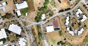
Volatus Team Sets Up
ASTRALiTe’s EDGE ™ is the world’s first small-scale topographic and bathymetric scanning LiDAR that can detect small underwater objects, measure shallow water depth, and survey critical underwater infrastructure from a small UAV platform.
ASTRALITE’s patented 2-in-1 top-bathy LiDAR overcomes the limitations of traditional bathymetric LiDAR, measuring underwater features at centimetre-level depth resolution. From coastal mapping and surveying to infrastructure inspection and military logistics, the applications of our LiDAR are numerous and widespread.
Safety, Safety, Safety
Our teams are required to wear safety gear including visibility vests and hard hats.
A solid Safety Management System (SMS) drives our corporate culture. We take a systematic approach to managing safety risks, and our SMS provides an organized way to set goals, make plans and measure our performance.
Our crew takes safety seriously and provides detailed reports, especially when testing new equipment.