Advanced Geomatics & Geospatial Intelligence Solutions
Modern infrastructure, engineering, and environmental projects rely on accurate geospatial intelligence and scalable surveying capabilities. Our geomatics and mapping operations support organizations with high-precision aerial surveying, LiDAR acquisition, photogrammetry, terrain modelling, and geospatial analytics for informed planning and operational decision-making.
Using integrated aerial and terrestrial acquisition platforms equipped with LiDAR systems, RGB imaging, multispectral sensors, RTK/PPK positioning, and advanced geospatial workflows, we deliver survey-grade mapping products and digital intelligence tailored to complex operational requirements.
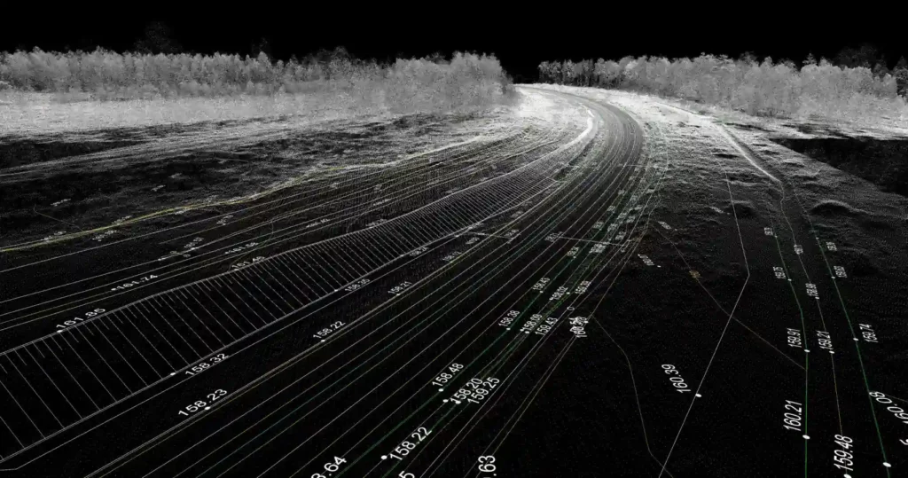
Generation of accurate 3D environments and digital representations supporting planning, engineering, and asset management.
Integrated sensing systems and advanced geospatial workflows supporting high-accuracy mapping and surveying operations.
High-density laser scanning technologies supporting terrain modelling, corridor mapping, and vegetation penetration analysis.
High-resolution aerial imagery processing supporting orthomosaics, 3D reconstruction, and mapping deliverables.
Survey-grade positioning systems ensuring high-accuracy and repeatable geospatial data acquisition.
Advanced aerial imaging systems supporting mapping, environmental analysis, and land classification workflows.
Generation of terrain models, surface models, contours, and elevation datasets for engineering and planning applications
Integrated geospatial processing workflows supporting mapping analysis, visualization, and operational intelligence.
Combined crewed and remotely piloted aerial operations supporting scalable geospatial acquisition across varying project scales.
Creation of accurate digital environments supporting infrastructure planning, engineering analysis, and asset management.
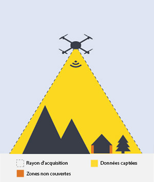
High-accuracy and flexible geospatial data acquisition for small to medium operational areas, remote terrain, and high-resolution mapping missions.
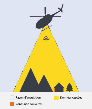
Efficient large-area aerial acquisition supporting corridor mapping, regional surveys, infrastructure monitoring, and long-range geomatics operations.
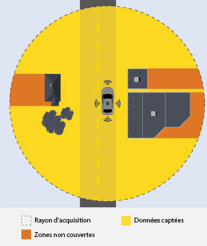
Vehicle-mounted LiDAR and imaging systems supporting transportation corridors, roadway mapping, rail infrastructure, and urban data acquisition.
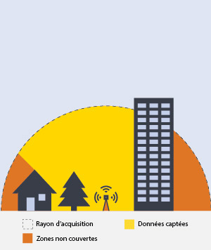
High-density survey-grade point cloud acquisition for engineering, architecture, industrial facilities, and detailed infrastructure modelling applications.
High-accuracy mapping deliverables compatible with CAD, GIS, BIM, and engineering workflows.
Georeferenced and classified LiDAR datasets supporting terrain, vegetation, and infrastructure analysis.
Detailed elevation and surface datasets supporting engineering design and environmental analysis.
High-resolution geospatial visualization products supporting planning, inspection, and asset management workflows.
Support engineering, infrastructure, and environmental operations with high-accuracy aerial surveying, LiDAR acquisition, and spatial analytics workflows.
Accurate geospatial intelligence enables organizations to improve planning accuracy, optimize project execution, enhance operational visibility, and make data-driven decisions across large and complex environments.
Advanced acquisition systems deliver highly accurate and reliable geospatial datasets for engineering and operational applications.
Aerial and mobile mapping technologies significantly improve survey efficiency across large or difficult-to-access areas.
Support for localized surveys, corridor mapping, regional acquisition, and recurring monitoring operations.
Detailed terrain, infrastructure, and environmental intelligence supporting planning, analysis, and operational decision-making.
We are more than a drone service provider, we are an enterprise aerial intelligence partner.
Combined crewed and remotely piloted aerial operations supporting diverse mission requirements.
Multi-sensor data acquisition integrated with geospatial and analytical workflows.
Experienced mission planning, regulatory coordination, and reliable field execution.
Processed insights, technical outputs, and actionable reporting beyond raw aerial data collection.
Leverage advanced geomatics, LiDAR, and aerial mapping capabilities to support accurate surveying, infrastructure planning, and operational intelligence workflows.
Real-time aerial visibility and operational awareness across complex environments.
Smart and Intelligent Monitoring Across Land, Forest & Agriculture