Classified point clouds
.LAS / .LAZSeparate ground, vegetation, structures, and other features within the dataset (LAS/LAZ).
CLASSIFICATION / 4 CLASSES

Lidar uses laser pulses to capture three-dimensional information about terrain, vegetation, infrastructure, and other physical features. The resulting point cloud provides a detailed spatial record that can be used for surveying, terrain modelling, corridor mapping, infrastructure assessment, and environmental analysis.
Volatus combines aerial and terrestrial lidar acquisition with GNSS/INS positioning, post-processed (PPK) trajectories, and geospatial processing to produce survey-grade datasets, with accuracy verified against independent checkpoints. Depending on the project, outputs can include classified point clouds, digital terrain models, digital surface models, elevation data, 3D models, and other GIS-read
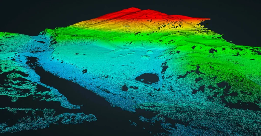
Lidar stands for Light Detection and Ranging. A lidar sensor emits laser pulses and measures the time taken for each pulse to return after hitting a surface. These measurements are combined with positioning and inertial data to calculate the location of each return in three dimensions.
The resulting point cloud contains millions of spatially referenced points representing terrain, vegetation, structures, and other features within the survey area.
A single laser pulse can also produce multiple returns as it passes through vegetation. Part of the pulse reaches the ground through gaps in the canopy, which makes lidar particularly useful for mapping terrain under vegetation, where conventional aerial imagery only sees the top of the canopy. Ground return density decreases under dense, leaf-on vegetation, so leaf-off acquisition is preferred when bare earth is the priority. Volatus lidar systems include multi-echo capabilities on selected platforms.
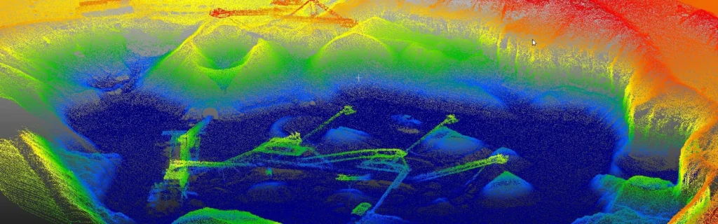
Lidar mapping starts with mission planning around the required coverage, point density, terrain, asset type, accuracy, and deliverables. Point density is set by flight altitude, speed, line spacing, overlap, and the sensor’s pulse rate.
A lidar payload collects laser measurements while GNSS and inertial systems record the position and orientation of the sensor. The sensor trajectory is post-processed (PPK) against a base station to georeference the collected data accurately. Independent checkpoints surveyed on the ground are then used to verify the final accuracy.
The resulting point cloud is processed and classified to separate ground, vegetation, structures, and other relevant features. Derived datasets can then be generated for terrain modelling, elevation analysis, infrastructure mapping, volumetric measurement, and 3D modelling.
Volatus supports lidar workflows using aerial UAV platforms as well as terrestrial and vehicle-mounted systems. This allows the acquisition method to be selected around the site and the required data rather than limiting the survey to one platform.
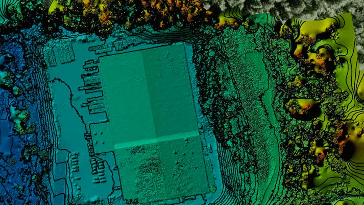
Separate ground, vegetation, structures, and other features within the dataset (LAS/LAZ).
Represent the bare-earth surface for elevation, slope, drainage, grading, and terrain analysis.
Represent the elevation of the ground together with structures, vegetation, and other surface features.
See survey geometry become connected triangles, reconstructing facilities and built assets.
Equal-elevation lines describe slope, ridge lines and changes in terrain.
A measured stockpile surface is compared with a defined reference base.
Processed datasets can be incorporated into existing geospatial and engineering workflows (GeoTIFF, DXF/DWG, SHP).
Checkpoint results documenting the vertical and horizontal accuracy achieved.
Capture the same area at defined intervals using the same control and flight parameters to establish a consistent spatial record.
Compare point clouds and derived models to identify changes in terrain, structures, vegetation, or site conditions. Changes are reported against the measured accuracy of each survey, so real change can be separated from survey noise.
Extract elevation, clearance, position, dimensions, and other spatial measurements from the point cloud.
Separate vegetation from ground data to assess canopy structure, encroachment, and terrain beneath vegetation.
Position measurements and features within the surveyed coordinate system for use in GIS and engineering workflows.
Build detailed spatial datasets that can support digital twins, planning, inspection, and asset management.
Volatus combines UAV, vehicle-mounted, and terrestrial lidar acquisition to address different site conditions and survey requirements.
Lidar data can be processed for terrain modelling, strip adjustment, colorization, classification, and visualization rather than being delivered as unprocessed sensor
High-precision trajectory processing supports accurately georeferenced lidar data and repeatable mapping workflows.
Results are checked against independent ground checkpoints and documented in an accuracy report.
Lidar can be combined with RGB imagery, photogrammetry, multispectral data, and other sensors when additional visual or spectral information is required.
Volatus provides access to lidar systems suited to different requirements, including high-density mapping, long-range acquisition, vertical mapping, mobile mapping, and topo-bathymetric applications with the YellowScan Navigator.
Volatus lidar systems include platforms capable of high point densities and multiple returns for detailed terrain, vegetation, and infrastructure mapping.
Lidar measures distance using laser pulses and produces three-dimensional point cloud data. Photogrammetry reconstructs spatial information from overlapping imagery.
Lidar is particularly useful for terrain mapping under vegetation, thin features such as wires and poles, elevation analysis, and three-dimensional infrastructure data, and it is less dependent on lighting conditions. Photogrammetry provides high-resolution visual information, orthomosaics, and image-based 3D reconstruction, but it only models the top of the canopy and needs good, even lighting and textured surfaces.
The two technologies can also be used together. Combining lidar with RGB imagery provides both three-dimensional measurements and visual context within the same geospatial workflow.
Tell us the site, area, terrain, asset type, required accuracy, and deliverables. Volatus will recommend the appropriate lidar platform, positioning and control approach, acquisition workflow, and data products for the project.