Most lidar Stops at the water’s edge. Topo-bathy lidar doesn’t. Using a green-wavelength laser purpose-built to penetrate clear, shallow water, Volatus captures a continuous elevation model from dry land straight through the water colurnn to the bottom, in a single flight. NO dive teams, no boat-based bathymetry, no gap between the topo survey and the hydrographic one.
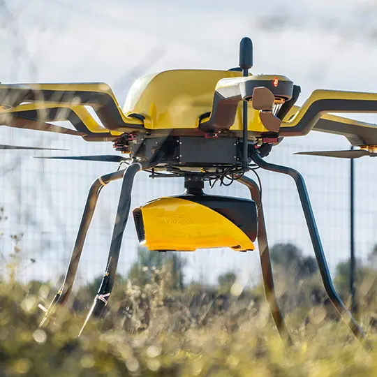
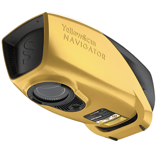
We’re adding a new tool to our lidar fleet: the YellowScan Navigator, a dedicated bathymetric payload built for clear, shallow water. Unlike our standard topographic lidar sensors, the Navigator uses a 532nm green laser to penetrate the water column and return a signal off the bottom, giving us a continuous elevation model from dry land through the shoreline and into the submerged bed, in a single flight.
This is a distinct payload from our topographic lidar systems, not an add-on to them, and it opens up survey work that a standard lidar sensor simply can’t capture: the transition zone where land meets water. It’s also a rare capability in this space. Most topo-bathy lidar today is still limited to crewed aircraft; the Navigator brings that same integrated land-and-water dataset to a UAV platform.
We fly the Navigator on our drone platforms, purpose-built for shallow, clear-water environments. The system weighs 3.7 kg, delivers up to 45 minutes of mission time per battery, and operates at up to 3 cm precision, with penetration depth scaling to water clarity on site.
Repeat surveys at the same site over time, compared as a time series to track shoreline retreat or bank advance.
Volumetric change detection (cut and fill) between surveys, quantifying material lost or gained rather than just visually flagging it.
Before-and-after capture around storm events, spring freshet, or ice breakup, to document rate and extent of change.
Identifying undercutting and toe erosion below the waterline that a land-only or water-only survey would miss entirely.
Supporting data for regulatory reporting, infrastructure risk assessment (roads, pipelines, utility crossings near banks), and restoration or armouring project design.
our team has delivered topographic and bathymetric lidar on tidal rivers, with the operational know-how for precise low-tide and pre-freshet timing
Rare in the UAV space: most topo-bathy lidar is still crewed-aircraft only; the Navigator brings that integrated capability to drone-based surveying.
Drone-based capture: agile, targeted deployment for shallow, clear-water sites without the cost and lead time of a crewed aircraft or boat-based survey.
One deliverable, not two: a single integrated point cloud instead of stitching together separate topo and bathy datasets from different vendors.
Canada-wide operational footprint with the regulatory and BVLOS experience to fly complex sites efficiently.
Talk to our team about your site’s water clarity, depth range, and timing window. We’ll tell you straight away whether topo-bathy lidar is the right fit.