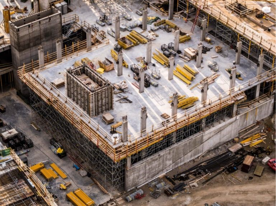
Construction projects move quickly, but progress reporting often doesn’t. Project managers spend their time reviewing sites, documenting work, resolving disputes, and collecting updates from multiple contractors. On large or complex sites, inspections can take days, while inaccessible areas often go undocumented.
Drone mapping provides a faster, more consistent way to monitor construction progress. A single flight captures the entire site, creating accurate visual records that project teams, clients, and remote stakeholders can access from anywhere. Instead of relying on scattered updates, everyone works from the same source of truth.
What Can Drone Mapping Deliver?
Different projects require different types of data, but three deliverables are used most often.
Orthomosaic Maps
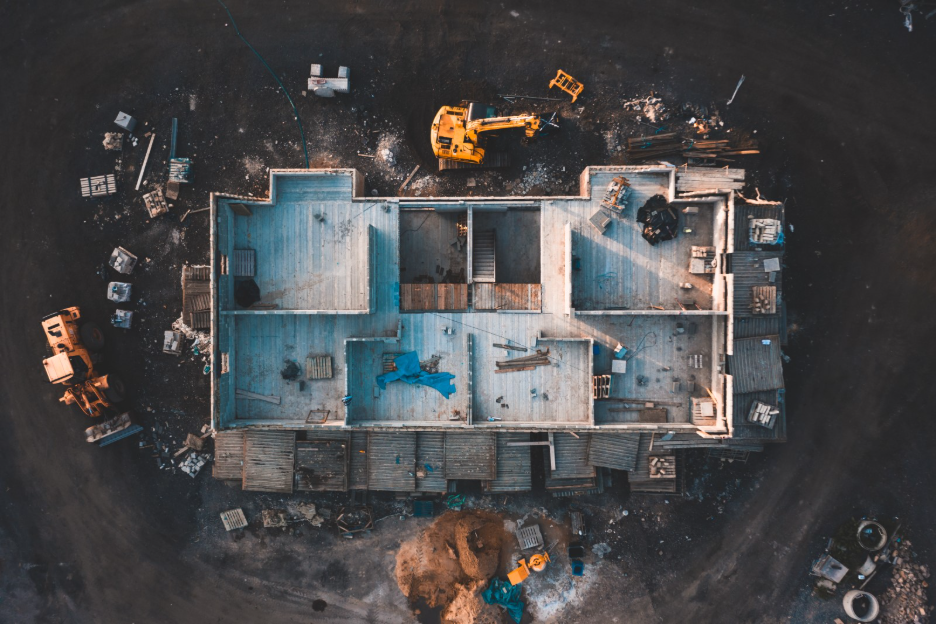
An orthomosaic is a high-resolution aerial map created by stitching together hundreds of overlapping drone images using photogrammetry. Unlike a standard aerial photo, it is corrected for camera angle and terrain, allowing accurate measurements across the entire site.
Construction teams use orthomosaic maps to:
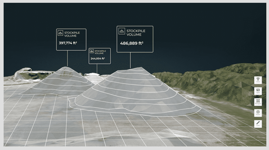
- Measure distances, areas, and stockpile volumes.
- Monitor grading, drainage, and site development.
- Inspect rooftops and difficult-to-access areas.
- Document site conditions for reporting or dispute resolution.
Software such as DroneDeploy and Pix4D allows measurements and annotations directly on the map.
Point Clouds and 3D Models
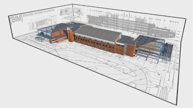
Drone imagery can also generate point clouds and surface models that integrate with Building Information Modelling (BIM). Comparing the as-built site with the original design helps identify faults early, verify completed work, and improve collaboration between project managers, contractors, and clients.
Progress Video
While maps provide measurements, aerial video provides context. Regular flyovers show how work is progressing, making it easier to communicate updates to clients, investors, and remote stakeholders. Completed footage can also be repurposed for marketing and project documentation.
How Drone Mapping Works:
Professional drone mapping follows a straightforward workflow.
1. Plan the Mission
The project boundary is imported into flight planning software using a KML or KMZ file. The pilot then identifies site obstacles, determines a safe flight altitude, and selects the most appropriate flight pattern.
Parallel flights are ideal for orthomosaic maps, while crosshatch flights with an angled camera produce higher-quality 3D models.
2. Capture the Site
A typical mission includes a full-site mapping flight, additional low-altitude imagery for detailed inspections, and, where permitted, higher-altitude images or video for broader site context.
3. Process and Share
The collected imagery is processed into orthomosaic maps, surface models, point clouds, or videos before being shared with project teams through mapping or project management platforms.
What Project Managers Monitor
Regular drone surveys give project teams a reliable record of construction progress. They help monitor:
- Trade completion and project milestones.
- Change orders and design modifications.
- Material storage and site logistics.
- Safety compliance and emerging hazards.
- Delays or unexpected site issues.
Because surveys can be completed weekly or daily, they provide a much clearer picture of project progress than traditional site inspections.
Why Construction Teams Use Drone Mapping
The biggest advantage of drone mapping is not the drone, rather it’s the quality of information it provides. Frequent, consistent aerial surveys make it easier to compare progress over time, identify issues early, and keep every stakeholder working from the same data.
Key benefits include:
- Reducing manual inspections and site visits.
- Detecting issues before costly rework is required.
- Improving communication across contractors and clients.
- Keeping remote stakeholders informed without travel.
- Creating a permanent visual record of project progress.
By replacing the inconsistent site updates with accurate, repeatable data, drone mapping helps construction teams improve efficiency, reduce disputes, and make better decisions throughout the project lifecycle.
Key Mapping Terms: A few technical settings influence the quality of drone mapping results:
- Ground Sampling Distance (GSD): The amount of ground represented by each pixel. Lower GSD provides greater detail but requires more images.
- Image – Overlap: Overlapping images ensure accurate photogrammetry and high-quality map generation.
- Flight Direction: Flight paths can be adjusted to improve efficiency and account for wind or site layout.
- Gimbal Angle: Angled imagery (typically 25°–65°) captures building sides and improves 3D model accuracy.
- Payload : For each project, our team will match the payload’s technical specifications to the client’s expectations. Selecting the right tool is an expertise that greatly affects the final deliverables.
Conclusion
Construction projects generate thousands of decisions from start to finish, and those decisions are only as good as the information behind them. Drone mapping provides accurate, repeatable site data that helps teams monitor progress, identify issues early, and keep every stakeholder aligned. Whether you’re tracking earthworks, verifying completed work, or improving project reporting, regular drone surveys deliver the visibility needed to keep construction projects on schedule and informed.
Contact our team to discuss how recurring drone mapping can improve visibility, reporting and decision-making across your construction projects.