DJI

ZENMUSE H30 SERIES

Flagship All-Weather Multi-Sensor Payload

Meet the Zenmuse H30 Series

Transcending the limitations of day and night vision, the DJI Zenmuse H30 Series sets a new standard for aerial perception and imaging. Integrating up to five cutting-edge hardware modules into a single payload, it is engineered for mission-critical operations across public safety, power line inspection, and forestry.

Built to perform flawlessly in the harshest environments, the H30 Series features an IP54 dust and water resistance rating and operates reliably in extreme temperatures ranging from -20°C to 50°C. Powered by intelligent algorithms, it guarantees unparalleled clarity and secure data capture when it matters most.

Zenmuse

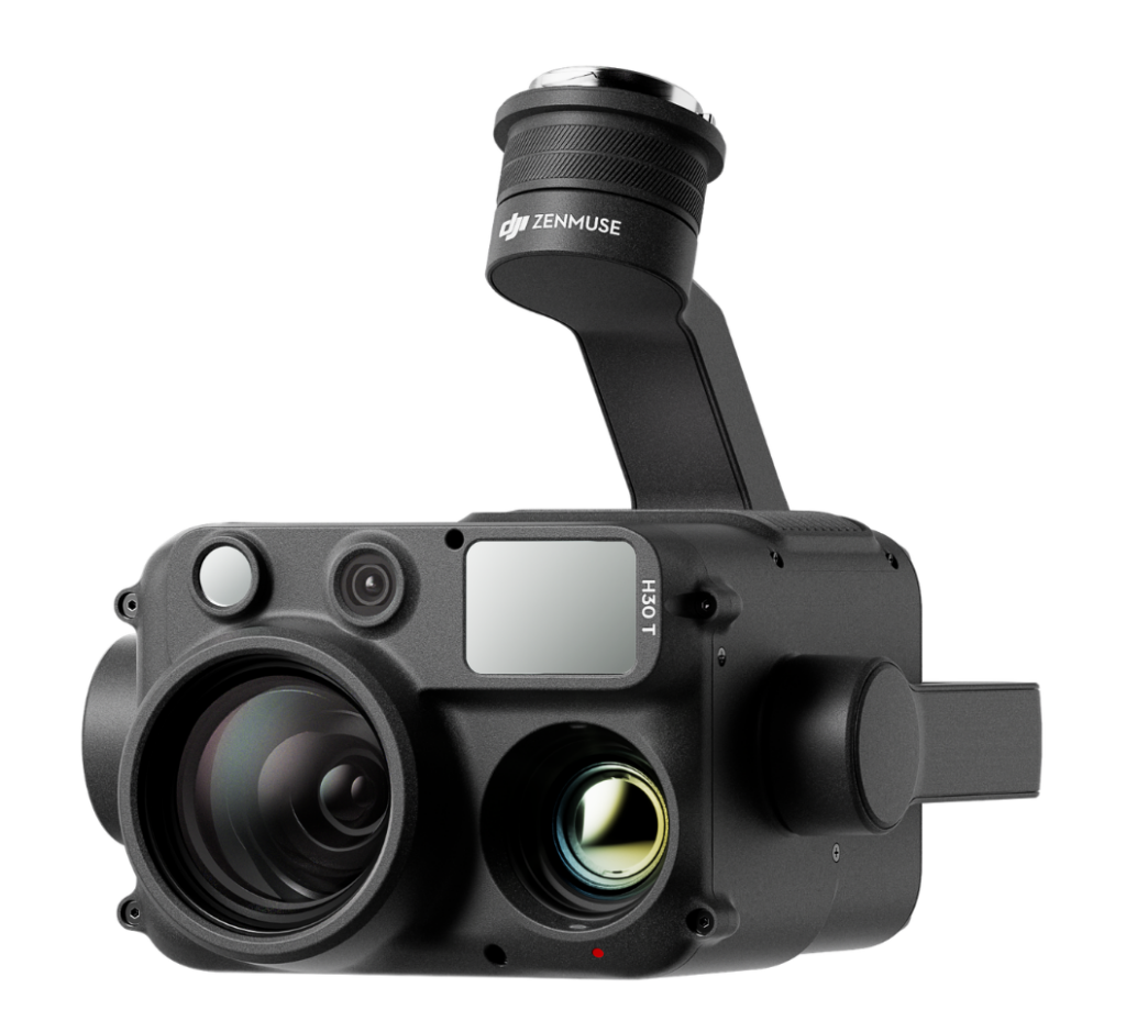
H30T

The Ultimate Tactical Advantage

The H30T includes all the features of the standard H30, plus a massive 1280 × 1024 Infrared Thermal Camera. Capable of measuring temperatures up to 1600°C (with density filter), it features Ultra-High Resolution (UHR) imaging and Link Zoom functionality for side-by-side thermal/visual comparisons.

Key Features

  • Thermal Resolution: 1280 × 1024 (H30T exclusive)

  • Optical & Digital Zoom: Up to 34× Optical / 400× Digital (40MP)

  • Laser Range Finder: 3 to 3000 meters distance calculation

  • Ingress Protection: IP54 Rating (Dust and water-resistant)

  • Operating Temperature: -20°C to 50°C (-4°F to 122°F)

Zenmuse

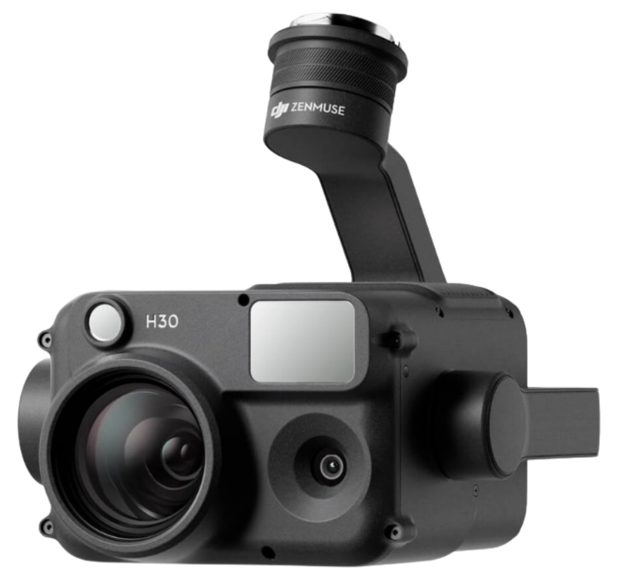
H30

The Standard Multi-Sensor Powerhouse

The Zenmuse H30 provides comprehensive visual data and laser-precise measurements for daytime and low-light operations. It is the ultimate multi-sensor powerhouse designed to execute demanding industrial and commercial workflows with absolute precision.

Key Features

  • Optical & Digital Zoom: Up to 34× Optical / 400× Digital (40MP)

  • Laser Range Finder: 3 to 3000 meters distance calculation

  • Ingress Protection: IP54 Rating (Dust and water-resistant)

  • Operating Temperature: -20°C to 50°C (-4°F to 122°F)

Precision Vision Beyond Limits

Advanced zoom, intelligent thermal imaging, and superior night operations engineered for mission-critical aerial intelligence and all-weather situational awareness.

Unmatched Zoom & Stabilization

Inspect critical infrastructure from a safe distance. The 40MP Zoom Camera utilizes DJI's latest image stabilization algorithm to completely diminish shake at extreme telephoto lengths. Built-in Electronic Dehazing pierces through smog and high atmospheric humidity to deliver crystal-clear data.

Master the Night

Operate seamlessly in the dark. The H30 Series supports Full-Color Night Vision and enhanced Black and White Night Vision by removing the IR filter. Paired with the integrated NIR Auxiliary Light, operators can safely conduct search-and-rescue and covert observations in complete darkness.

Next-Generation Thermal Imaging

See the unseen with 4× greater thermal resolution than previous generations. The H30T features a High-Res Mode designed specifically for identifying subtle temperature differences in people or animals, while Link Zoom allows simultaneous zooming of both visual and thermal cameras for immediate context.

Intelligent Software & Security

Never miss critical intelligence. Pre-Recording captures up to 30 seconds of footage before you even hit record, while Smart Capture automatically adjusts to high-dynamic lighting. All data is protected via AES-256 transmission encryption, microSD Security Codes, and one-click log clearance.

Application Scenarios

Public Safety & Search and Rescue

Utilize High-Res thermal imaging, Full-Color Night Vision, and NIR illumination to rapidly locate subjects in complex terrain or total darkness.

Power Line Inspection

Leverage 400× digital zoom and advanced image stabilization to identify micro-defects on high-voltage lines without risking pilot safety.

Firefighting & Forestry

Safely observe extreme temperatures up to 1600°C (with filter) and map out active wildfire boundaries through dense smoke using the 1280 × 1024 thermal sensor.

Oil, Gas & Water Conservation

Capture highly secure, encrypted data and utilize the 3000m Laser Range Finder to accurately measure and monitor critical infrastructure over vast distances.

At Volatus Drones, we recognize each industry faces unique challenges and requirements when choosing the perfect drone.

With an in-house team of drone experts with real-world mission experience across every sector, we can help you identify the best drone platforms and solutions that align with your specific goals.

Let's Build the Right Solution for Your Mission.

Fill out the form and our team will get back to you with the information you need.
REQUEST INFO