Computer vision and machine learning applied to aerial data — identifying defined defects, anomalies, and change across critical infrastructure, and flagging them for expert validation.
Aerial data provides valuable insight into infrastructure, equipment, and surrounding environments. Volatus uses ultra-high-definition cameras, thermal imaging, Lidar, and other sensors to capture detailed data for a wide range of inspection and monitoring applications.
AI analytics can be added to the workflow when projects require automated analysis of large volumes of imagery and sensor data. Using machine learning and computer vision, AI-powered tools can help identify defined objects, defects, anomalies, and changes, making it easier to review and organize inspection findings.
By combining aerial data, advanced sensors, analytical tools, and expert review, Volatus Aerospace helps turn complex datasets into structured information that supports inspection, monitoring, and asset management.
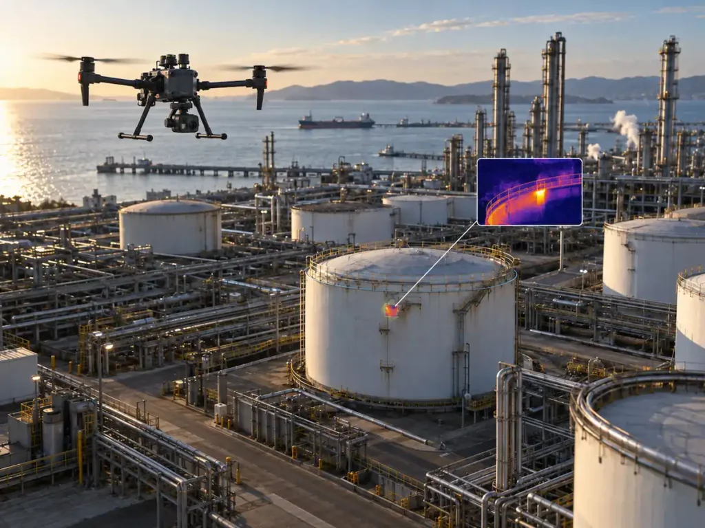
AI analytics is a capability that uses computer vision and machine learning to identify features and conditions within imagery and sensor data. It helps accelerate analysis and flag potential issues for human validation.
RGB images are analyzed to detect visual features and defects in infrastructure. Thermographic images reveal temperature variations. Lidar detects 3D point cloud information. The choice of sensors and analysis approach depends on the type of asset being inspected and the environmental conditions.
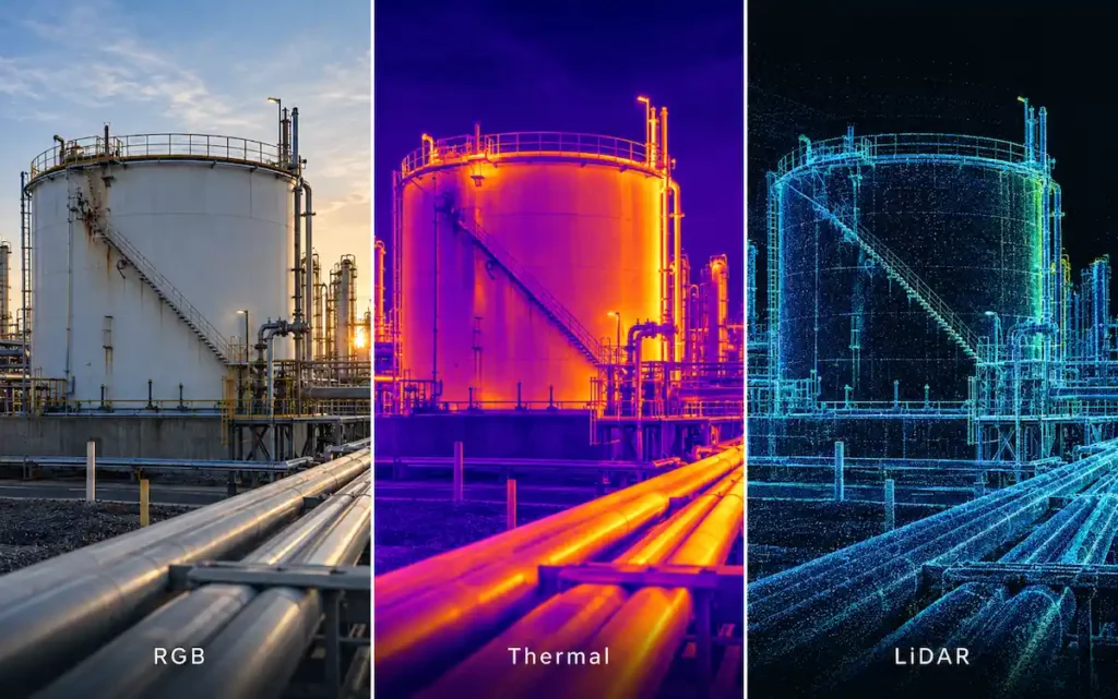
The process begins with aerial data collection using sensors selected for the specific application. Volatus deploys ultra-HD cameras, thermal imaging, Lidar, and other sensors to capture data from infrastructure, machinery, and surrounding environments.
The data is then processed using software that incorporates AI. Machine learning algorithms and computer vision can recognize changes, damage, temperature anomalies, objects, and other defined conditions.
For operations that need fast results, analysis can happen on-site or in the field. The processed findings are then geo-referenced and used in inspection, monitoring, reporting, and asset management.
Aerial data collection with sensors selected for the application.
AI software recognizes changes, damage, and anomalies.
On-site or in-field analysis when fast results are needed.
Geo-referenced findings for inspection, monitoring, and reporting.
Each inspection captures the asset condition at a specific point in time. When inspections are repeated, comparisons reveal any changes that have occurred.
A structured monitoring program provides:
AI processes large volumes of imagery using defined criteria, reducing manual review time.
Identification and categorization of specified objects or features.
Detection of visual conditions for further assessment and validation.
Identification of conditions that differ from baseline or surrounding assets.
Combination of RGB, thermal, Lidar, and other data when additional information is needed.
Comparison of repeat surveys to identify shifts in asset condition, structures, terrain, or site activity.
Organization of findings into inspection records for maintenance, compliance, and asset management.
Volatus's proprietary AIRS 3 Advanced Integrity Reporting System organizes inspection findings into structured, actionable reports. AI-powered analysis can be incorporated into this workflow when required.
Inspection findings can be linked to geographic and asset information for integration with GIS systems and further analysis.
Where immediate analysis is required, field-processing capabilities can support results being generated on-site or close to the point of data collection.
Volatus combines aerial data capture, multisensor technology, inspection workflows, and reporting software into an integrated inspection service. AI analytics can be added when a project requires automated analysis of specific objects, defects, anomalies, or changes.
Rather than replacing human inspection, AI-powered analysis helps process large volumes of imagery and prioritize findings for further review. The specific analytical tools used depend on the asset, sensor data, inspection objectives, and reporting requirements.
Multisensor technology allows Volatus to select RGB, thermal, Lidar, and other sensors according to the inspection application. Where appropriate, these datasets can be analyzed together to provide additional context.
Let us know the asset class, scale, required sensors, and what needs to be identified. Volatus will advise on the best approach for data collection, analysis, and reporting and whether AI analytics is the right fit for your needs.