Photogrammetry uses overlapping aerial photographs to create accurate maps, measurements, and three-dimensional models of an area or object. It turns a series of images into spatial data that can be measured, analyzed, and used for surveying, planning, and asset management. Each image captures the subject from a different position.
Photogrammetry software identifies common points across the images and uses them to reconstruct the geometry of the subject. The result is an orthomosaic for mapping, a point cloud for measurement, a digital surface model for elevation analysis, or a 3D model for visualization and inspection.
RTK and PPK positioning provide accurate georeferencing for captured imagery, while ground control points can be added where additional survey control is required. The appropriate combination depends on the required accuracy and site conditions.
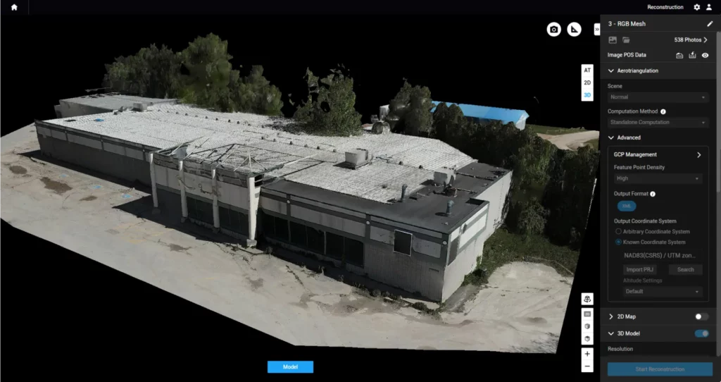
The same site can be captured at fixed intervals, creating a consistent record of construction progress, terrain change, stockpile movement, or asset condition.
Every image and derived dataset is tied to its geographic position, allowing measurements and findings to be located precisely.
One capture produces multiple outputs, from orthomosaics and elevation models to point clouds and 3D models.
Surface models allow stockpile and material volumes to be calculated, and changes between surveys are to be tracked.
Repeat datasets can be compared to identifying where terrain, structures, or site conditions have changed.
Volatus drones are equipped with lidar can be added to provide dense three-dimensional data where vegetation, terrain or structural complexity limits photogrammetry.
Volatus supports photogrammetry workflows using platforms including Pix4D and DJI Terra for processing imagery into maps, point clouds and 3D models.
Volatus combines aerial acquisition with terrestrial geomatics capabilities, allowing the survey method to match the site and required deliverable.
For projects that call for operations beyond standard visual-line-of-sight limits, Volatus has the regulatory experience and operational planning to scope and execute accordingly.
High-accuracy positioning supports georeferenced aerial data and repeatable mapping workflows.
Tell us the site, the scale, and what mapping data already exists. We will recommend the right photogrammetry approach, including the aircraft, sensors, positioning and deliverables required, and say so if photogrammetry is not the right fit.