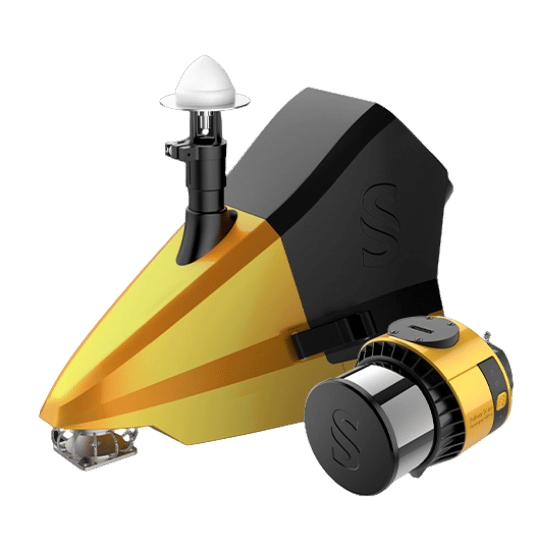
The YellowScan Fly & Drive is an incredibly versatile, dual-use mobile mapping system. Built around the powerful Surveyor Ultra LiDAR unit, it empowers operators to collect highly accurate, geo-referenced point clouds from both land vehicles and UAVs.
Whether you are navigating strict no-fly zones, capturing vertical street-level elements, or conducting massive aerial surveys, this system adapts to your mission instantly. By expanding your range of capabilities with a single payload, the Fly & Drive dramatically increases your Return on Investment and drastically reduces your system’s payback period.
| Precision | 2 cm |
|---|---|
| Accuracy | 3 cm |
| Typ. driving speed | Up to 90km/h |
| Typ. flight speed | 10 m/s |
| Max. AGL altitude | 140 m |
| Point density | Surveyor Ultra: 60 pts/sqm @ 100m AGL 10 m/s |
| Laser range | Surveyor Ultra: Up to 300m |
| Laser scanner | Surveyor Ultra: Hesai XT32M2X |
| GNSS-Inertial solution | Surveyor Ultra: SBG Quanta Micro |
| Scanner field-of-view | Surveyor Ultra: 360° x 40.3° |
| Echoes per shot | Surveyor Ultra: Up to 3 |
| Shots per second | Surveyor Ultra: Up to 640 000 |
| Scanning frequency | Surveyor Ultra: Up to 20 Hz |
| Weight | Surveyor Ultra: 0.98 kg (2.2 lbs) batt. excl. |
| Size | Surveyor Ultra: L 153 x W 113 x H 117 mm |
| Autonomy | Surveyor Ultra: 1.2 hour typ. |
| Power consumption | Surveyor Ultra: 20 W |
| Operating temperature | Surveyor Ultra: -10 to +40 °C |
Fully compatible with the YellowScan Fly&Drive mobile mapping pod
Everything required for dual-domain mapping. Includes the sub-1kg Surveyor Ultra unit, the rugged Fly & Drive vehicle Pod, a dedicated DJI M300/350 Mounting Bracket, the AV18 GNSS Antenna, and a custom 3.2kg hardshell backpack. (Optional odometers and roof-bar adaptors available).
Generate data in just a few clicks. Includes a CloudStation Essential license, empowering operators to extract, process, and display point cloud data immediately after acquisition. Features proprietary modules for Terrain modeling, Strip Adjustment, Colorization, and Classification.
Pre-configured for "Drive Mode" and ready to use upon receipt. Every system includes a factory calibration certificate, a 1-Year Warranty, 1-Year of Unlimited Technical Support, and an intensive 2-day training program conducted on-site or online.
Fill out the form and our team will get back to you with the information you need.