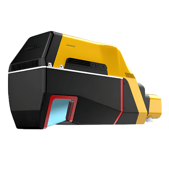
The YellowScan Voyager is the ultimate high-altitude LiDAR solution, engineered for large-scale enterprise mapping. Capable of operating at an AGL altitude of up to 440m (1444ft), it effortlessly covers massive territories while maintaining an astonishing 1cm system accuracy and 0.5cm precision.
By capturing up to 2 million useable points per second with an unmatched 2400 kHz data acquisition rate, the Voyager ensures absolute data integrity. Whether you are mapping dense jungles, vertical cliff faces, or vast urban landscapes, this payload delivers survey-grade reality capture at an unprecedented scale.
| Precision | 0.5 cm |
|---|---|
| Accuracy | 1 cm |
| Typ. flight speed | 10 m/s |
| Max. AGL altitude | 440 m |
| Point density | 24 pts/sqm @ 300 m AGL 30 m/s |
| Laser range | Up to 1250 m |
| Laser scanner | RIEGL VUX-120²³ |
| GNSS-Inertial solution | Applanix AP+ 30 AIR or AP+ 50 AIR |
| Scanner field-of-view | 100° x 20° |
| Echoes per shot | Up to 32 |
| Shots per second | Up to 2 400 000 |
| Scanning frequency | Up to 400 Hz (selectable) |
| Weight | 3.5 kg (7.7 lbs) battery excl. |
| Size | L 369 x W 117 x H 183 mm |
| Autonomy | 1 hour typ. |
| Power consumption | 98 W |
| Operating temperature | -10 to +40 °C |
Optimized for precision hovering, tight-quarter navigation, and rapid deployment in complex environments.
Built to withstand unique vibration profiles while leveraging the extended flight times and wind resistance of single-rotor platforms.
Optimized for rapid, large-scale linear mapping and wide-area coverage, maximizing the terrain captured during a single flight.
Built to maximize the Voyager’s high-altitude capabilities for large-scale mapping missions.
Built for immediate, large-scale deployment. Includes the 3.5kg Voyager Unit, a dedicated GNSS Antenna AV18, two 14.4V batteries with a charger, two 256GB Samsung USB keys for massive data storage, and a rugged Pelicase for secure transport.
Extract, process, and display data in a few clicks. Includes a CloudStation Essential license and Applanix POSPAC MMS. Increase your productivity with YellowScan’s proprietary modules for powerful Terrain processing, Colorization, Strip Adjustment, and Classification.
Fly immediately upon receipt with absolute confidence. Every Voyager includes a factory Boresight Calibration Certificate, a 1-Year Warranty, 1-Year of Unlimited Technical Support, one remote Healthcheck, and a comprehensive 2-day training program available in-person or online.
Fill out the form and our team will get back to you with the information you need.