In demanding survey environments, uncertainty is costly. Survey missions are often constrained by tight timelines, limited access, regulated platforms, and strict data security requirements.
Surveyors, including government contractors, need easy-to-deploy equipment with multi-UAV compatibility and full control over locally processed data to deliver survey-grade results with confidence.
Designed specifically for surveyors and government contractors operating under tight timelines and strict security protocols, the YellowScan Venturer delivers unmatched reliability. Designed and manufactured in France, this payload is fully NDAA-compliant, guaranteeing that your sensitive mission data remains 100% under your control through fully local processing.
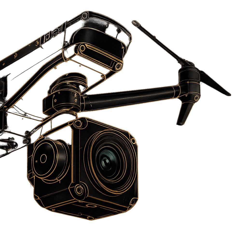
By integrating the industry-leading RIEGL Mini-VUX 3 UAV scanner with the Trimble Applanix APX-RTX IMU, the Venturer eliminates the trade-offs between coverage, data quality, and operational efficiency. It’s not just a LiDAR scanner; it’s a secure, survey-grade intelligence hub.
In modern surveying, uncertainty is costly. Tight timelines, difficult terrain, and strict data-security requirements demand a system that is both precise and dependable. The Venturer is engineered to overcome these challenges, delivering survey-grade accuracy while simplifying complex field operations.
Built with full NDAA compliance and secure local data processing through CloudStation, it keeps sensitive project data fully under your control. Its quick-release multi-UAV compatibility and intuitive “Yellow Touch” display enable faster deployment and confident operation in the field. Whether mapping critical infrastructure or complex public-sector environments, the Venturer helps teams capture clean, high-density point clouds accurately on the first flight.
Everything required for immediate secure deployment. Includes the 2.45kg Venturer Unit, a dedicated GNSS Antenna AV18, two 14.4V batteries, and a custom hardshell backpack for rugged transport. (Optional 26MP/61MP camera modules available).
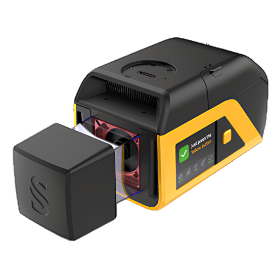
Extract, process, and display your data immediately after landing. Includes the YellowScan CloudStation ecosystem featuring powerful modules for Terrain generation, Colorization, Strip Adjustment, and Classification—all processed securely offline.
Fly immediately upon receipt. Every Venturer includes a factory Boresight Calibration Certificate, a 1-Year Warranty, 1-Year of Unlimited Technical Support, and a comprehensive 2-day training program available on-site or online.
Fill out the form and our team will get back to you with the information you need.