
DJI

ZENMUSE L3

See Through, Far and True – DJI’s First Long-Range, High-Accuracy Aerial LiDAR

Meet the Zenmuse L3

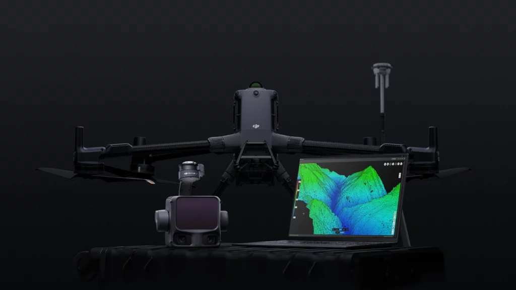
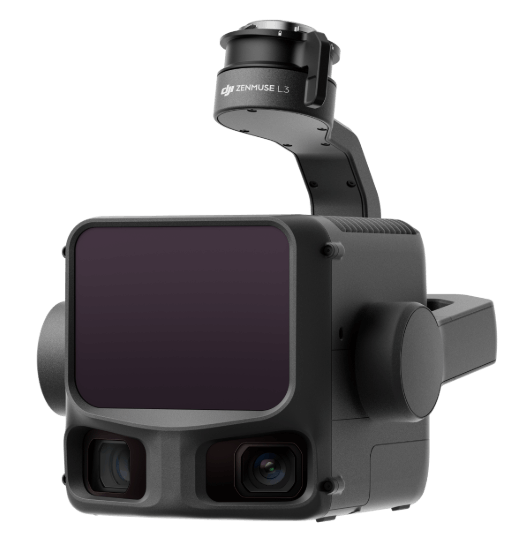
The Zenmuse L3 is a next-generation, high-accuracy aerial LiDAR system designed to push the boundaries of enterprise surveying. It integrates a 1535nm long-range LiDAR, dual 100MP RGB mapping cameras, and a highly upgraded POS system—all seamlessly mounted on an ultra-stable three-axis gimbal.
Engineered for ultimate efficiency and canopy penetration, the L3 reaches detection ranges up to 950 meters. When paired with the flagship DJI Matrice 400, operators can achieve daily mapping coverage of up to 100 km² with pristine centimeter-level accuracy, fundamentally transforming workflows in forestry, engineering, and topography.

Zenmuse

L3

Key Features

  • Maximum Detection Range: Up to 950 m (even at 10% reflectivity)

  • Daily Mapping Efficiency: Up to 100 km² coverage

  • Vertical Accuracy: Better than 5 cm at 300m altitude

  • Pulse Rate & Returns: 2 million pulses/sec with up to 16 returns

  • Laser Beam Divergence: 0.25 mrad (captures ultra-fine details like power lines)

The Complete Aerial Surveying Payload

A compact, all-in-one powerhouse. The Zenmuse L3 achieves a ground sample distance (GSD) of 3 cm at a 300m flight altitude and operates entirely without the need for ground control points (GCPs). It empowers professionals to capture digital orthophoto maps (DOM) and digital elevation models (DEM) in a single flight with just a 20% LiDAR side overlap ratio.

Core Payload Components

  • 1535nm Long-Range LiDAR: Emits up to 2 million pulses per second and supports up to 16 returns for maximum penetration through dense environments.

  • Dual 100MP RGB Mapping Cameras: 4/3 CMOS sensors with a mechanical shutter and an ultra-wide 107° horizontal FOV.

  • High-Precision POS System: Achieves heading accuracy of 0.02° and pitch accuracy of 0.01° (post-processed).

Intelligent Scanning & Imaging Performance

Adapt to any mission with advanced scanning modes including Linear for high-accuracy terrain mapping, Star-Shaped for enhanced forest penetration, and Non-Repetitive scanning for complex structural and power line inspections. Paired with dual 100MP RGB sensors and advanced pixel binning technology, the system delivers exceptional 25MP imaging with superior color accuracy and crystal-clear photogrammetry even in challenging low-light environments.

Integrated Workflow & Enterprise Security

Experience a seamless end-to-end mapping workflow across DJI’s ecosystem. Generate real-time 3D SLAM point clouds in DJI Pilot 2, create highly realistic LiDAR Gaussian Splatting models in DJI Terra, and leverage intelligent semantic classification in DJI Modify for automatic detection of terrain, vegetation, and power lines. Enterprise-grade protection includes CFexpress™ memory card encryption, AES-256 encrypted video transmission with the Matrice 400, and one-click log clearing to safeguard sensitive operational data.

Application Scenarios

Topographic & Engineering Survey

Achieve mapping projects at 1:500, 1:1000, and 1:2000 scales with ultra-precise point clouds and microsecond-level time synchronization.

Power Line Inspection

Automatically follow transmission lines up to 130m altitudes. The ultra-tight 0.25 mrad beam divergence easily detects thin wires and surrounding branches.

Forestry Management

Leverage up to 16 returns and Star-Shaped scanning to effortlessly penetrate dense canopies and generate accurate digital elevation models (DEM).

Earthwork & Mining Survey

Quickly calculate volumes and analyze terrain with instant 2D/3D previews and real-time cloud synchronization to DJI FlightHub 2.

At Volatus Drones, we recognize each industry faces unique challenges and requirements when choosing the perfect drone.

With an in-house team of drone experts with real-world mission experience across every sector, we can help you identify the best drone platforms and solutions that align with your specific goals.

Let's Build the Right Solution for Your Mission.

Fill out the form and our team will get back to you with the information you need.
REQUEST INFO