
Real-time aerial intelligence and autonomous capabilities to detect wildfires earlier, accelerate decisions, and strengthen response across Canada.
Wildfire conditions can change in minutes. The sooner incident commanders can see where a fire is moving, understand emerging risks and track resources in the field, the better positioned they are to protect crews, communities and critical infrastructure.
Volatus Aerospace brings together crewed and uncrewed aircraft, persistent aerial intelligence, resilient communications, heavy-lift autonomous platforms and mission-control expertise to support wildfire preparedness, active response and recovery.
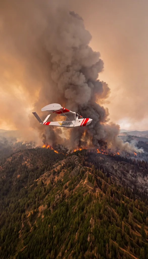
Effective wildfire management begins before smoke is visible and continues long after the immediate threat has passed. Volatus supports wildfire agencies across preparedness, detection, active response, and recovery.
Through its strategic partnership with Singular Aircraft, Volatus is advancing the introduction of the FlyOx 1 as a heavy-lift autonomous aircraft capability for Canadian wildfire response.
Heavy payload capacity, long endurance, amphibious capability, automatic takeoff and landing, and the ability to operate from unprepared airstrips create options for forward deployment closer to emerging incidents.
Through its strategic partnership with Kraus Hamdani Aerospace, Volatus is advancing the introduction of the K1000ULE ultra-long-endurance autonomous aircraft and ATNE++ resilient airborne communications architecture to support Canadian wildfire operations.
The fully electric K1000ULE is designed for continuous operations across large and remote environments. Combined with ATNE++, it can support electro-optical and infrared intelligence, live fire-perimeter mapping, thermal hotspot detection, communications relay, responder tracking and unified-command coordination throughout an incident.
A simulated incident. The gold line is an aerial sensor pass when it physically crosses an emerging hotspot, detection happens. Hover the map for live geo-referenced coordinates.
Demonstration interface. Actual missions operate subject to applicable regulatory, airspace, safety and operational requirements.
Match the aircraft, sensor and operating model to the mission—from rapid local assessment to persistent regional monitoring and heavy-lift support.
Transform visual, thermal, telemetry and geospatial data into a common operational picture that supports incident-command decisions.
Coordinate aircraft, data and field operations through experienced mission planning, regulatory support and centralized operational oversight.
Deploy capabilities for a single incident, a regional program or a sustained national requirement while complementing existing wildfire-management resources.
Whether you are preparing for the next fire season, strengthening persistent monitoring or evaluating autonomous aircraft for active response and recovery, Volatus can help define operational requirements, identify the right mix of capabilities and develop a pathway that works within Canada’s regulatory and incident-command environment.